From the Rideau Tennis club down to the Queensway, is a snow covered wonderland during the winter of 2012.
It would be much appreciated if the NCC could find a way to plough the path as the city has found a way to plough from Hurdman to the bridge.
These pillars are directed at empowering the entire community to break the cycle of poverty
education,
alternative income and livelihood,
health care,
clean water and sanitation, and
agriculture and food security.
Create community projects designed to be owned and maintained by the community, and self-sustained
within five years after project implementation is complete.
promote solidarity, not charity.
learn and share with community members in order to gain a valuable experience.
begin making a difference, armed with a new perspective and understanding of our role in the global community.
Hands-on volunteering and the opportunity to give back in a meaningful way
Social issues education
Renewed sense of community: Helping to redefine the sense of empathy,
compassion and a full understanding of the power of communalism.
Action planning: All participants set goals and build personalized action plans
Engaging and collaborating with local community members at the
outset of any development project in order to address the issues that
community members have identified as important.
Developing and building the capacity of community members to assume leadership and management of the implemented projects.
Providing families (especially women) with opportunities to
participate in alternative income and micro-credit programs, and
equipping them with the skills and tools—such as financial literacy
training, business planning workshops and leadership seminars—to be
successful entrepreneurs and give back to their community.
Developing the potential of "merry go rounds" (and other similar
traditional lending and savings initiatives) to increase income and
livelihood for families.
Tackling local environmental issues and providing solutions based on
indigenous knowledge to ensure programs can be sustained by both
community and the land.
The sidewalk is simply too narrow and the roadway too close to the sidewalk, watch out for the rear view mirrors of buses, and dumptrucks. They may take your head off!
My suggestion is to remove the north sidewalk and widen the south sidewalk. Move the bike lane to the south side as well and separate it from traffic using bollards.
"More and more people discover that if you sit down and figure out a
route, 95% of the route is just fine," said CFSC president Hans Moor.
"It is often a crossing here, an oddly designed shoulder there, that gives a perception that cycling is not safe. But it is."
The recently released document combines National Capital Commission
and municipal initatives, examining the state of cycling in Bytown.
An estimated 300 accidents were reported each year between 2007 and
2010 but that figure remains constant, even with an increase of riders,
the report finds.
It highlights improvements made since 2010, such as better signage at
the train culvert on Carling Ave. between Herzberg Rd. and Moodie Dr.
In addition, better lighting and signage have been installed at the
University of Ottawa underpass so cyclists can ride below Nicholas St.
and the Transitway, linking them with the Corktown Bridge.
Other areas lack progress, such as a bypass for cyclists to the
Merivale Rd. shopping strip, and signage to get downtown from the Ottawa
River pathway.
"Many of our indicated problems need more than a year to put into place," said Moor.
"The city is definitely listening, but going through the motions takes awhile."
Connections such as the Byron-Tyndall-Gladstone are currently being studied.
The group is also asking the city to focus on linking Laurier Ave.
with the Ottawa River pathway, and Bank St. near Billings Bridge.
"Not everyone realizes that a bike network is incredibly cheap," said Moor.
"Ottawa has many parts in place already, and if we fix a number of problem spots, we all of a sudden have a complete network."
The growth of cycling is so overwhelming, there isn't enough parking, said Moor.
Meters were replaced with pay and display kiosks, however, more spots
will become available as the city redevelops areas such as Bank St. in
Centretown and Wellington St. W.
The site parkmybike.ca is user-driven, pointing out areas with and without adequate facilities.
The NCC, though, is doing well with its Park-and-Cycle program.
The 2011 pilot project saw 360 spots for commuters who partially drove to work, parked for free in a lot, then cycled.
The NCC confirmed the program is ongoing until Nov. 15, weather permitting.
kelly.roche@sunmedia.ca
@ottawasunkroche
The first Cummings Bridge, erected in 1836, linked Bytown and
Gloucester. The bridge crossed the Rideau River, via the island lying
just south of today's bridge, where the Cummings family lived and ran a
general store. A community called Cummings Bridge sprang up in the
surrounding area. This community would eventually become known as
Vanier. The early wooden bridge was replaced first by the Cummings family
(who charged a toll for the new bridge) and again later by Ottawa
lumberman (and later mayor) Samuel Bingham in 1893. In thanks for
Bingham's investment, the City renamed the bridge after him. However,
angry community residents tore down the name plaque and threw it in the
river. As a result, we still know the bridge as Cummings Bridge. Today's bridge, built in 1921, is the bridge's fourth incarnation. In
the summer, you can often spot Ottawa's royal swans from the bridge or
the nearby banks of the Rideau River.
taken from :
http://capitalneighbourhoods.ca/english/sandy-hill/story-266.aspx
The bridge promoted the migration of working-class families from Bytown
to what became Vanier. At the beginning of the 19th century, the lumber
industry was a catalyst for the development of the region. The
soon-to-be capital needed food as well as products and services from the
surrounding countryside. Originally, Vanier had an agricultural
calling, with many gardeners and farmers settling in the area. The Cummings were located on an ideal site. First, they opened a
general store to serve pioneering families from Junction Gore, the area
that encompassed the headland at the junction of the Rideau and Ottawa
rivers. Under the management of Robert Cummings, eldest son and heir of
the family business, the store flourished and rapidly became a regional
supply centre. Gradually, Robert Cummings diversified his activities and
began to manufacture horse-drawn carriages. His general store was also
the only one to hold a post office and, later, the only telephone
service in town. As a prominent citizen, he was involved in local
politics for almost 50 years. After 1845, both the population and traffic rapidly increased in the
region. Robert Cummings undertook the construction of a second, stronger
wooden bridge. He collected a toll from its users. The City of Ottawa
built a metal bridge in the early 1890s to meet more adequately the
needs of the community. Much more than a link between the two shores,
Cummings Bridge allowed the continued development of businesses in
Janeville, Clandeboye and Clarkstown. The Island Today…
Around 1920, the City of Ottawa decided to build a new bridge on the
Rideau River a dozen metres to the north of Cummings Island. The new
bridge, which no longer spanned the island, nevertheless kept the name
of Cummings Bridge. In 1922, the City of Ottawa bought the island and
demolished the general store of the Cummings. No one has inhabited the
island since. The only architectural remains on the island are the
bridge pillars built in 1890. In the 1990s, the municipal council of
Vanier proposed to acquire the island and rebuild the general store to
create a local heritage site, but the plan never materialized.
Taken from : http://www.museoparc.ca/circuitvanier/circuit-vanier-2/montreal-road-circuit/cummings-island/
History and Description
Overbrook West - Mc Arthur is bounded on the north by Montreal, and a number of other roads including Mc Arthur. To the south lies Highway 417, St. Laurent Boulevard is to the east, and the Rideau River lies to the west. The Duke Cornwall and the Duchess of York visited Ottawa in 1901. Ten years later, upon the death of King Edward VII, the Duke and Duchess acceded to the throne as King George V and Queen Mary. Within a year, the first reference to Overbrook is found on a map published by Thorburn & Abbott. The community of Overbrook had two streets named after the newly crowned King and Queen commemorating their coronation, and a third street commemorating the consort of Queen Victoria, Prince Albert.
The People
As of the 2006 census, Overbrook West - Mc Arthur had 11,464 residents. The population consists mainly of young and middle aged adults, which is representative of most neighbourhoods in the City of Ottawa. The distribution across age groups was as follows: 10% were children under 9 years of age, 13% were youth aged 10 to 19, 27% were young adults aged 20 to 39, 39% were middle aged adults aged 40 to 69, and 10% were seniors aged 70 to 89.
In terms of knowledge of official languages, 40% of Overbrook residents reported that they could speak or understand English only, 5.4% reported they could speak or understand French only, 54 reported that they could speak or understand both English and French, and 0.9% reported that they knew neither English nor French.
This neighbourhood is fairly diverse; 25% of the residents reported that they represent a visible minority and 2.7% of residents identified as Aboriginal (First Nations, Inuit or Métis). Thirty percent of the population immigrated to Canada between 1996 and 2006, and 15% were recent immigrants (i.e. came to Canada between 2001 and 2006). Twenty-six percent of residents ages 15 and over were first generation immigrants, 11% were second generation immigrants, and 63% were third generation or higher. Among the immigrants, 39% were from Asia or the Middle East, 20% were from Africa, 11% were from the Caribbean, 2.6% were from the United States, 18% were from Europe, and 8% were from South or Central America.
In 2006, the average individual income in Overbrook West - Mc Arthur was $30,848, and average household income was $51,900; these are below the Ottawa averages of $34,844 and $86,848, respectively. After tax, twenty-nine percent of residents live below the Low Income cut-off (LICO, which is an important poverty benchmark), this much higher than the city average of 14.1%, but has decreased slightly from 30% in 2001. Thirty percent of children in the Overbrook West - Mc Arthur area were living below the LICO (Ottawa average: 16.8 %), while 5.6% of seniors in the area were living below the LICO (Ottawa average: 6.9%). Of residents living in families, twenty-eight percent were in lone parent families. Thirty-six percent of Overbrook West - Mc Arthur’s seniors were living alone.
The population was fairly educated; 29% of residents did not complete high school, 26% completed high school, 7.6% completed an apprenticeship or trades certificate, 15% completed college or CEGEP and 22% completed a bachelor’s degree.
The neighbourhood socio-economic index is based on average income, percent below the LICO, the unemployment rate, the percent of people with less than a high school education, and the percent of families that are lone parent. Based on this index, neighbourhoods were divided into quintiles, with 1 representing most advantage and 5 representing the least advantage. Overbrook-Mac Arthur is in the 5th socio-economic quintile.
Employment
Fifty-nine percent of Overbrook’s residents participated in the labour force. The unemployment rate was 8.2% (Ottawa neighbourhood average: 5.9%), and youth unemployment was relatively low, at 10% (Ottawa neighbourhood average: 13.8%). Of those who were employed, 53% worked full-time, 40% worked part-time, and 6.5% did not work in the year before the census. Forty-five percent of residents did unpaid work, including housework and unpaid care for seniors or children.
Transportation to Work
Among those who worked, 49% drove a car, truck, or van to work, 11% rode in a car, truck, or van as a passenger, 26% used public transit, 8.2% walked to work, 3.8% bicycled to work, and less than 1.4% used other methods of transportation to work.
Housing
Overbrook-Mac Arthur is an older neighbourhood; more than half of the dwellings were built before 1960. Eleven percent of the dwellings were constructed in the period before 1946, while another 39% were constructed between 1946 and 1960. Seventeen percent were built between 1961 and 1970, 32% were built between 1971 and 1995, and only 4% were built between 1996 and 2006.
By 2006, Overbrook had 4710 dwellings: 22% were single detached, 8.1% were semi-detached, 14% were row houses, 18% were apartments with more than 5 stories and 32% were apartments with less than 5 stories. The majority (59%) of residents rented, while 40% owned their homes. Housing is unaffordable for many residents in the neighbourhood: 31% of residents pay more than 30% of their income on shelter (above the city average of 24%). Eleven percent of the dwellings were reported to be in need of major repairs (above the city average of 6.4%). The number of people per room, a measure of crowding, was above the city average (0.38), at 0.46.
Civic Engagement and Responsibility
Overbrook West - Mc Arthur residents are not well engaged in the political process, with 38% of eligible voters voted for mayor in the last municipal election (Fall 2006); this is lower than the city average of 48%. The neighbourhood is also mobile, with 15% of residents moving within the last year; this is higher than the city average of 14%. Fifty-five percent (55.4% ± 11.5%) felt a sense of belonging to the neighbourhood; this is near the city average and similar to the average for the 5th SES quintile neighbourhoods. In 2006, the property crime rate was 111.2 crimes per thousand people, a much higher rate than the city average of 42.7 per thousand people. Personal crime rates were also much higher than the city average of 6.5 per thousand, at 21.1 per thousand people.
Overbrook has 12 religious organizations within its borders, with a ratio of 1.05 religious organizations per thousand people.
Overbrook also has an active community association. For more information on this, see the City of Ottawa directory at: http://ottawa.ca/info/contactus/blue_pages_en.html#P610_5368.
Neighbourhood Resources for Health
(Note that the food data is up to date as of September 2008, while the other data was updated in September 2007.
Food
Overbrook West neighbourhood has good access to grocery stores, specialty stores, and convenience stores. It also has high access to fast food outlets.
This neighbourhood has 6 grocery stores, or .52 per thousand people, and 11 specialty food stores (.96 per thousand people). The closest grocery stores and specialty stores are 704.84 meters away (an 11 minute walk1) and 262.84 meters (a 4 minute walk) away, respectively, from the population weighted center.
Overbrook has 15 convenience stores (1.31 per thousand people) and 33 fast food outlets, or 2.9 for every thousand people. The closest convenience store is located 235.86 meters away (a 4 minute walk) from the population center and the closest fast food outlet is 381.49 meters away (a 6 minute walk). Three (75%) of Overbrook schools are within 500 meters (or an 8 minute walk) of a fast food outlet.
Overbrook also has 16 sit-down restaurants or 1.40 per thousand and the average distance to the closest four restaurants is 831.89 meters from the population center.
Greenspace
Overbrook has .63 km2 of greenspace available or .06 kms of greenspace per thousand people; this is much lower than the city average of .26 km² per thousand people.
Parks and Recreation
Overbrook has some opportunities for recreation. In total, it has 41 recreation sites, or 3.58 per thousand people. Specifically, it has three sites for winter recreation (.26 for every 1000 people), 36 sites for summer recreation (3.14 for every 1000 people), and two indoor recreation facilities (.17 for every 1000 people). In 2007, 51.8% of this neighbourhood’s residents reported using a recreational facility (source: RRFSS). The neighbourhood also has 11.06 km of bike/walking paths, or .96 meters of bike/walking paths for every resident.
In 2007, 89% of the residents reported being aware of walking, biking, or nature trails in Ottawa, while 70.3% reported using walking, biking, or nature trails (source: RRFSS). Overbrook has 25.6 m2 of park space for every resident; this is below the City average of 34.3 m2 per resident. With a recreation index score (combines all recreation per thousand, bike paths, and parks) of 46, Overbrook has slightly below average opportunities for recreation (city average = 50).
Education and Culture
Overbrook has four schools. The closest City of Ottawa library branch is located 1,712.47 meters from the population center; this is slightly lower than the city average.
Financial services
This neighbourhood has seven banks with a ratio of .61 banks per thousand people. This is higher than average for the Ottawa area. It has four ‘less healthy financial services’ sites (cheque cashing, pawn shop or payday loan outlets) or .35 per thousand people. This is higher than the city average.
Health services
Compared to other neighbourhoods in Ottawa, Overbrook is well served by pharmacies, with 0.38 per thousand people. The average distance to the four closest physicians from the population center is 1,140.24 metres; this is below the average distance for the Ottawa area (1,941.7 meters). Data from the 2001 to 2007 Canadian Community Health Surveys show that the proportion of residents who have a regular medical doctor is 90.1% (± 4.9%): this is near the City average (88.3% ± 1.0%) and significantly higher than the 5th SES Quintile average (83.0% ± 2.8%). The proportion of residents who have ever had a flu shot was 55.2% (± 9.6%); this is lower, but not significantly different than the Ottawa average (62.0% ± 1.5%) or the average for the 5th quintile (64.6% ± 3.3%).
The proportion of residents who visited a dentist in the past year (55.6% ± 11.6%) is not significantly different than the 5th SES quintile average (60.7% ± 3.5%), but is significantly lower than the City average of 73.4% (± 1.5%).
Neighbourhood Health Outcomes
Please note that the results from the Canadian Community Health Survey (CCHS) represent combined data from the 2001, 2003, 2005 and 2007 cycles. Results from the Rapid Risk Factor Surveillance System (RRFSS) represent combined data from 2003 to 2007 for self-rated health, body mass index (BMI), and physical activity.
The health of Overbrook residents is generally poor compared to the average for the Ottawa area. For example, 57.1% (± 8.6%) of residents rated their overall health as excellent or very good in the years 2003 to 2007. This is below, but not significantly different than the Ottawa average of 64.5% (± 1.2%).
In terms of reproductive health, the rate of low birth weight single births in the years of 2002 to 2007 was 5.8 per hundred births: this is higher than the city average of 4.3 per hundred births. The rate of preterm births of 7.5 per hundred was higher than the Ottawa average (6.4%) and near the average for the 5th socio-economic quintile (7.2%). The rate of teen births was 5.9 per hundred; this is higher than the Ottawa average of 2.3 per hundred and the 5th quintile average of 5.4 per hundred.
The rate of hospitalization for Ambulatory Care Sensitive Conditions (conditions such as asthma, diabetes, cellulitis, angina, and hypertension) between 2003 and 2007 was 1,494.2 (± 216.1) per hundred thousand people; this is significantly higher than the city average (976.1 ± 21.2), but not significantly different than the average for the 5th socio-economic quintile (1,318.0 ± 62.1). The rate of emergency room visits for the same conditions between 2003 and 2007 was 8,568.9 (± 505.9) per hundred thousand people; this is significantly higher than both the City average of 5,806.1 (± 50.3) and the average for the fifth socio-economic quintile (7,599.4 ± 145.1). Hospitalization rates for unintentional injuries between 2003 and 2007 were 599.9 per hundred thousand people (± 139.4); this is higher, but not significantly different than the Ottawa average of 472.2 (± 15) and similar to the 5th quintile average of 616.55 (± 43.0). The rate of ER visits for unintentional injuries of 11,198.3 (± 578.5) per hundred thousand people was significantly higher than that for the Ottawa area (8,765.6 ± 61.5) and lower, but not significantly different than that of the rate for neighbourhoods in the 5th socioeconomic quintile (11,486.2 ± 178.2).
In terms of physical activity, 51.8% (± 10.3%) of the residents were inactive in their leisure time (CCHS 2001 to 2007); this is not statistically different than either the Ottawa average or the average for the 5th socio-economic quintile. Seventy-eight percent of residents (± 8.1%) were moderately or highly physically active across all daily activities during the years 2003 to 2007; this is similar to the Ottawa average (78.5% ± 1.1%) and near the average for the 5th socio-economic quintile (75.8% ± 3.0%). Fifty-seven percent (± 8.6%) of the residents aged 18 years and older reported overweight or obese BM Is (RRFSS; years 2003 to 2007); this is higher, but not significantly different from the averages for either the Ottawa area or for the 5th socio-economic quintile. Twenty-four percent (24.4% ± 5.5%) consumed 5 to 10 servings of fruit and vegetable servings per day in the years 2001 to 2007. This is significantly lower than both the Ottawa average of 40.2% (±1.5) or the average for the 5th socio-economic quintile (46.5% ± 3.2%).
Only 63% of residents (± 8.0%) lived in smoke-free homes during the years 2003 to 2007 (RRFSS); this is significantly lower than the Ottawa average (74.9% ± 1.1%) and near the average for the 5th socio-economic quintile (65.6% ± 2.9%).
School Readiness
The Early Development Instrument (EDI) measures the school readiness of kindergarten children on five major domains; physical health and well-being, social competence, emotional maturity, language and cognitive development, and communication skills and general knowledge. If a child scores below 90% of other Ottawa children on a domain, he or she is considered ‘vulnerable’ on that domain. Importantly, 56.9% (± 9.31%) of kindergarten children residing in the Overbrook West - Mc Arthur neighbourhood were rated as vulnerable on the Early Development Instrument (EDI) in Year 2006, while the city average is 29.3% (± 1%). Additionally, 43.1% (± 9.3%) of neighbourhood children were vulnerable on TWO or more domains of school readiness (City average = 15.8, ± 0.8%).
Neighbourhood Strengths and Challenges
Overbrook West - Mc Arthur has a number of strengths including a good age and linguistic mix, an active community association, and good access to grocery and specialty stores. However, the large number of people who live below the LICO may find it difficult to afford food. Overbrook West-Mc Arthur also has very high child poverty and a high proportion of lone parent families. The high poverty and unemployment rates and the need for affordable housing are concerns; both individual and household incomes are well below City averages. The extremely high crime rates are a cause for concern. The number of ER visits and hospitalizations for Ambulatory Care sensitive conditions are also a concern. One of the most important concerns is the fact that a high number of kindergarten children living in this area are not ready for school. Poorer than average birth outcomes are another cause for concern.
1 Based on an average walking speed of 1.1 metres per second
(http://www.state.nj.us/transportation/publicat/pdf/PedComp/pedintro.pdf)
Interpret with caution – high sampling variability
taken from http://web.ncf.ca/leonardo7/articles/historyofOverbrook.htm
A Brief History of Overbrook
Early signs of development of our community are evident on a map of Gloucester Township published in 1876. A large tract of land is shown owned by Fred & Samuel Sparks. They are part of the well known family that was one of the original Bytown pioneers. This property extends from the Rideau River east to the current St. Laurent Blvd., straddling both sides of a road that would later become Donald Street. In 1865 a fine double house had been constructed of limestone near the Rideau River by Nicholas Sparks. It still stands today at 936-940 North River Road. Other tracts of land are owned by Mrs. D. McArthur, the Sharp family, Alex Anderson and the Whellans.
One of the tragic events of this time period is a fire that apparently started in the bush of Gloucester Township, and raced through the area of Overbrook. Courtney C.J. Bond discusses it in his book Where Rivers Meet: An Illustrated History of Ottawa, published in 1984.
The summer of 1870 was dry, and by August Gloucester township reported bush fires. Fires then broke out on the north shore, as flames in Gloucester roared to the edge of the Rideau opposite Sandy Hill. By the 17th of August, the skies were overcast with smoke, and the air of the city was unpleasant. Telegraph poles on the north shore burned down, breaking direct communication with Montreal. The Ottawa Times tells how on August 19 the capital came under threat of destruction:
Early in the morning it was announced that the fires in the woods, of which we had heard so much during the past few days, were rapidly approaching...Families of refugees might be seen entering the city. Farmers walked wearily along, carrying all their worldly wealth upon their backs, and followed by their wives and little ones.
The fire swept through the centre of Hull in a mile-wide swath. Mill owners became alarmed. The Ottawa City Council organized a vigilance committee and called able-bodied people to fight the flames in the western suburb of Rochesterville. It also issued a proclamation closing all places of business.
The 60th Rifles and the Garrison Artillery marched to Hull; mill workers were sent out with wagons. The Times reporter went west through the suburb of Sherwood to "Lewis's Dam," the low St-Louis embankment impounding the north side of Dow's Lake. James Purcell, the foreman of Baldwin's mill, instructed his 100 men to cut through the dam, thereby releasing water to hold the fire from the western suburbs. Driving back to the city in hub-deep water, the reporter saw people burying their treasures. he wrote: "As we go to press the horizon in rear of New Edinburgh is crimson with the reflection of the fierce fires raging in that quarter."
As the flames died down the next day, citizens tallied the damage. Chelsea village in the Gatineau hills was untouched, but residents along the river had been forced to take refuge on rafts. In March township the "Horaceville" Estate was spared, but Major-General Lloyd's "Bessborough" and the Monk family's "Beechmount" were devastated shells. Although the countryside was burned into "one vast, blackened, burned, dismal-looking field," Ottawa was unscathed.
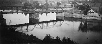
In 1875 one of the first bridges over the Rideau was built not far from the intersection of Presland Road and North River Road by W.H. Hurdman. He was Reeve of Gloucester Township from 1877-78. In 1906 the "Hurdman" bridge was replaced by one of the first bridges in Canada to be built of reinforced concrete.
The Duke and Duchess of Cornwall and York visited Ottawa in 1901. Upon the death of King Edward VII they acceded to the throne as King George V and Queen Mary. Within a year the first reference to Overbrook is found on a map published by Thorburn & Abbott. The community of Overbrook is found consisting of seven streets. Two of these streets appear to commemorate the newly crowned King And Queen, with a third commemorating the consort of Queen Victoria, Prince Albert. King George, Queen Mary and Prince Albert Streets run east from the Russell Road (now North River Road) to about the current location of the Overbrook Community Centre. Marion, Sharp and Vera Streets are also shown. The old CP rail tracks dissect the community, where the Vanier Parkway is currently.
Overbrook was beginning during a very difficult time in the history of Ottawa. A typhoid epidemic swept through Ottawa in 1909, with a more serious onslaught in 1911, with 67 deaths by April of that year. The disease abated, but the following year 20 people had died by July. The city's water supply was suspected as the source of the problem. In 1915 a pumping plant was built on Lemieux Island and the water brought over by a pipe suspended from a bridge. (For an online historical overview of Ottawa, go to the Bytown Museum website.)
On a map published by the City on June 26, 1912 King George, Queen Mary and Prince Albert Streets are shown running all the way to the current St. Laurent Blvd. Another railway line, identified as the Canadian Northern Railway, is also shown, following the hydro line right of way from just north of the current RCMP building to cross St. Laurent Blvd just south of Cyrville Road. The eastern boundary of the City of Ottawa is the Rideau River. Overbrook could be considered one of Ottawa's newest "suburbs".
Also in 1912 was the first reference to Overbrook in the Might's City Directory. Overbrook is described as a "District lying east of the Rideau River between Cummings Bridge and Hurdmans Bridge and immediately south of Eastview." Below is a list of the first 25 residents listed in the Directory.
For a look at one of the layout of the streets in Overbrook as of 1914, check the map You will also see how our neighbourhood was cut by railways.
By 1918 the first reference to the "Overbrook Annex Public School", located on King George St., is found. Isabelle Waterman is listed as the Principal. The Directory lists 79 other people in Overbrook. In 1919 we find the first reference to the Overbrook Post Office. John Sedvall is Post Master. Also in this year Laura E. Bradford replaces Isabelle Waterman as Principal of the Public School and 120 people are now listed in the Directory. By 1921 Clinton Pharoah has replaced John Sedvall as Post Master and almost 200 people are shown residing in Overbrook.
There were problems, however, as development spread east across the Rideau River. The most notable issue for development in this area was flooding of the River. The flood plain was quite extensive, as detailed in the Report of the Federal Plan Commission published in 1915, otherwise known as the "Holt Report". All of the current parkland west of North River Road is shown as subject to flooding. Here is how it was described at the time:
The area flooded by the Rideau River is situated for the most part on the east and south bank of the river. It extends all the way from Minto Bridge, through Eastview, to Bronson Avenue. Between the Minto Bridge and Hurdman's Bridge, the flooding is almost altogether on the east bank of the river. From Hurdman's Bridge to Bronson Avenue, it extends along both sides of the river. The total area flooded according to the elevations is about 1,050 acres.
The "Holt Report" also recommended that Somerset Street be identified as a major arterial road, extending across the city to the east, bringing traffic from Montreal. For this reason they recommended that bridges be built across both the Rideau Canal and Rideau River. This is why what we currently know as Donald Street was identified as Somerset Street until after the Second World War.
The first map so far found to detail a boundary for Overbrook was published by the City in 1936. On it Donald Street is referred to as Somerset Street.
Interesting demographic statistics of 1941 are discussed in Jacques Greber's Plan for the National Capital, published in 1948.
Compared to the other "suburbs" of Ottawa, Overbrook appears to be doing quite well. What particularly stands out is the very high percentage of home ownership.
On January 1, 1950 Overbrook was annexed by the City of Ottawa together with other large sections of Gloucester and Nepean Townships. In the annexation documents Overbrook is referred to as a "Police Village" and identified as part of "Township School Area #2. It states that "Overbrook....maintain(s) their own volunteer Fire Dept. with a Hose motor, and receives help from Gloucester Fire Dept. when required." It also had a playground consisting of a "parcel of land (measuring) 180' X 650', 3/5 improved. One softball diamond, one hockey rink, (and) temporary huts."
The City Library has several copies of old issues of the Overbrook News on file from the eighties and early nineties. It is hoped that in the near future we will be able to publish some of these documents on this website. Check back again in the near future.
taken from CBC: http://www.cbc.ca/news/canada/ottawa/story/2012/08/19/ottawa-overbrook-police.html
Somebody said...
"Overbrook was simply a place to exist. Most criminal activities took place outside of the neighbourhood or on its perimeter, in Vanier, except for breaking and entering, which did happen often enough in gentrified areas. Except for mischief and intimidation, it was an indoors thing, somewhere to rest and plot.
Overbrook was largely a collection of affordable housing units and homes, and that's why we were there. I'm not saying "upper class crime" doesn't exist, but everyone I knew back then lived in poverty or near poverty, almost always had single-parent homes (mothers) who could/would do nothing to stop us, and the local residents also had enough worries in their own lives (which we contributed to) to really do anything to stop or monitor our actions.
Help the parents, use plainclothes officers and unmarked vehicles. IMO, that's the best way without further traumatizing the residents with nonstop police presence. I can't think of any way police could have really stopped us without insiders bleeding information or violating basic rights."
Peter Karwacki is an avid whitewater kayaker out of Northern Ontario. He started paddling the Kipawa in 1985. One of its rapids, "Pete's Dragon" is named after him. He is the past president of Whitewater Ontario and Les amis de la rivière Kipawa. Supported by the paddling community and the Northern Ontario Liquid Adventures Club he presented his first paper to ENERGEX 2002 in Kracow, Poland. That paper was published in the European Journal of Applied Energy.
He wrote "Navigation of Water Control Structures" presented to the Canadian Dam Association. His Nanrimo quick book is called, Zen and the Art of Whitewater Kayakying. He is the co author of Paddle Tracks, a book of poetry published as a fundraiser for the Canadian Canoe Museum. You can find his entire resume on his website at:
http://www3.sympatico.ca/kayaky/peter.htm He has has paddled the Colorado, Gauley and the Ganges.
In 2019 he ran, unsuccessfully for councillor of Ward 13 in Ottawa, Ontario.
Peter Karwacki (Sr.)
Ottawa, Ontario
http://peterkarwacki.blogspot.com
http://www3.sympatico.ca/kayaky/NOLAC.htm
"The truth? that love is the ultimate and highest goal to which a man can aspire" Victor Frankl